Stewardship/Restoration
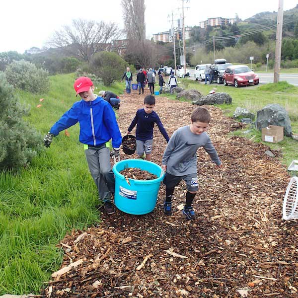
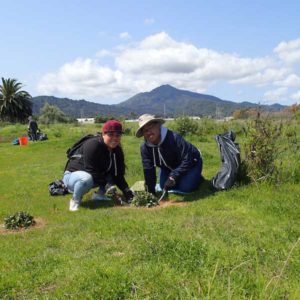
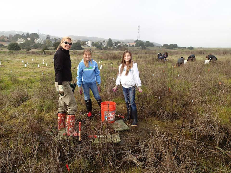
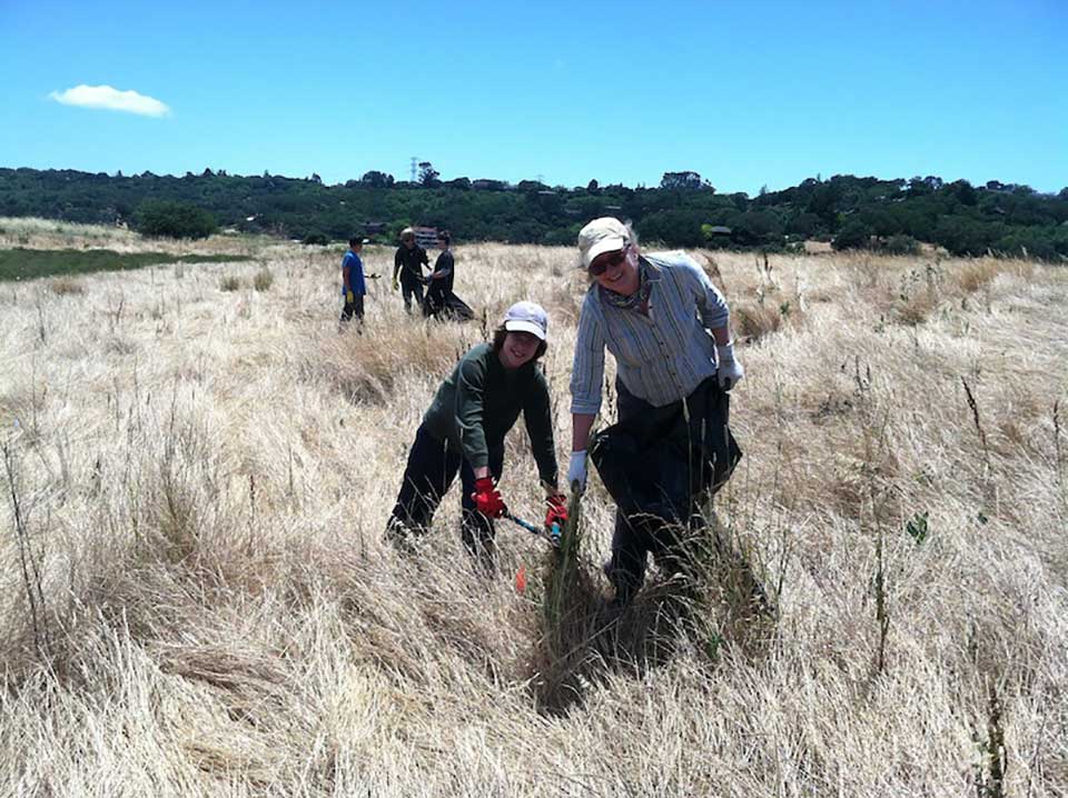
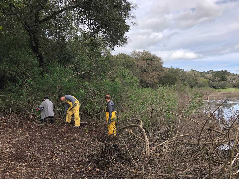
Volunteer Workdays
Corte Madera Ecological Reserve Restoration Project: Second Saturday of each month at 10 AM. Contact Martha Jarocki.
Location: on-site at the end of Industrial Way, can also be reached by parking behind Cost Plus, walking east, and then turning left on the levee to the end of Industrial Way.
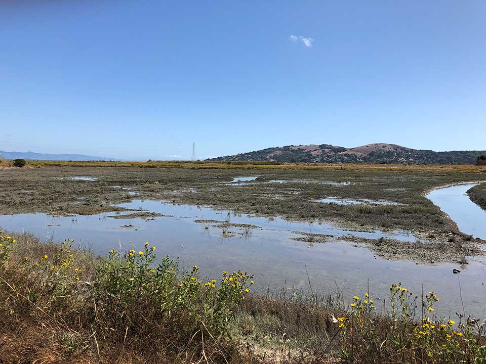
The tidal marsh and adjacent upland habitat were restored in 2017. See below for more details regarding our most recent tidal marsh restoration project. 18,000 native plants were added in 2018. An irrigation system was installed, and plants were watered every three weeks during the summer of 2019. Winter and spring maintenance work includes removing invasive plants that grow with the rains.
For more information please see: Volunteer Workdays for Habitat Restoration

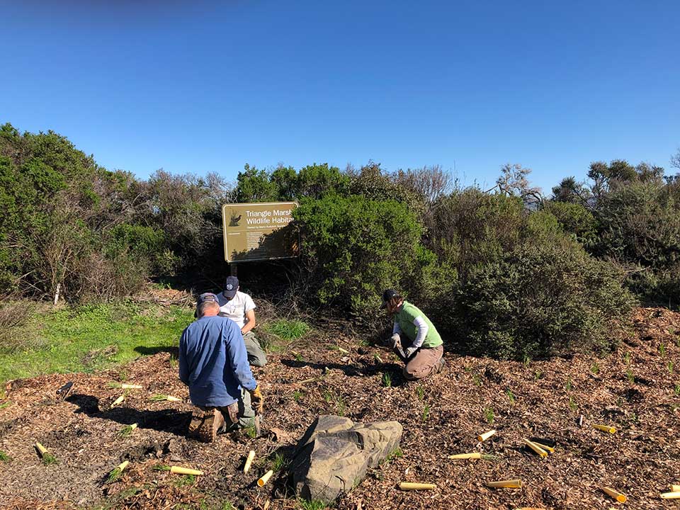
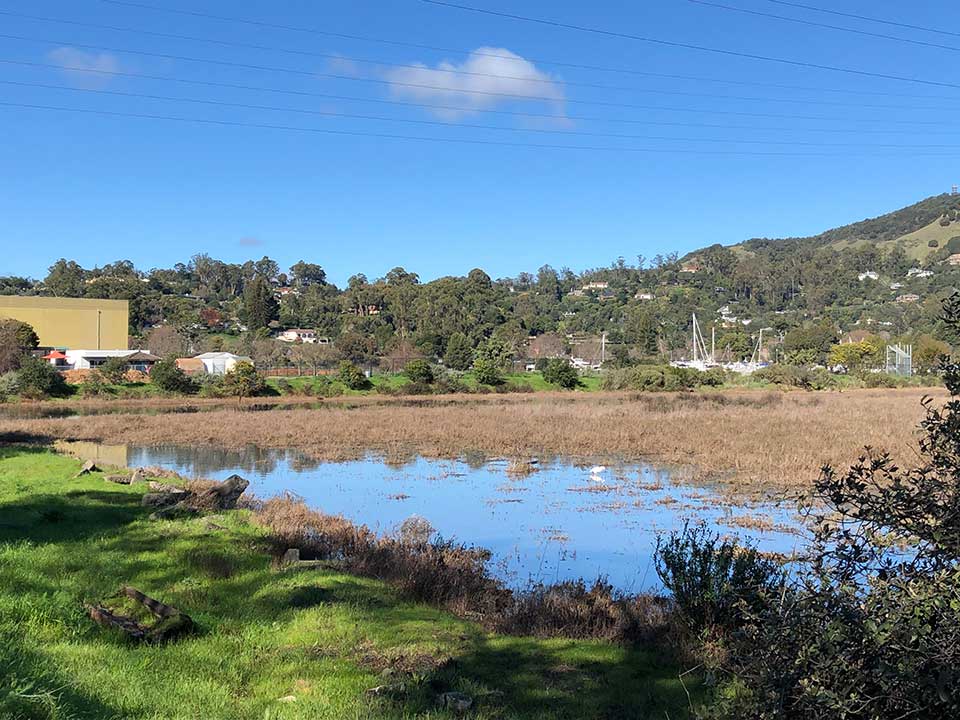
Triangle Marsh: Volunteer work takes place on the first Saturday of each month at 10 AM. Contact Bob Hinz at 415-383-8688 for information.
Location: On-site across from the Ring Mountain Preserve on Paradise Drive in Corte Madera.
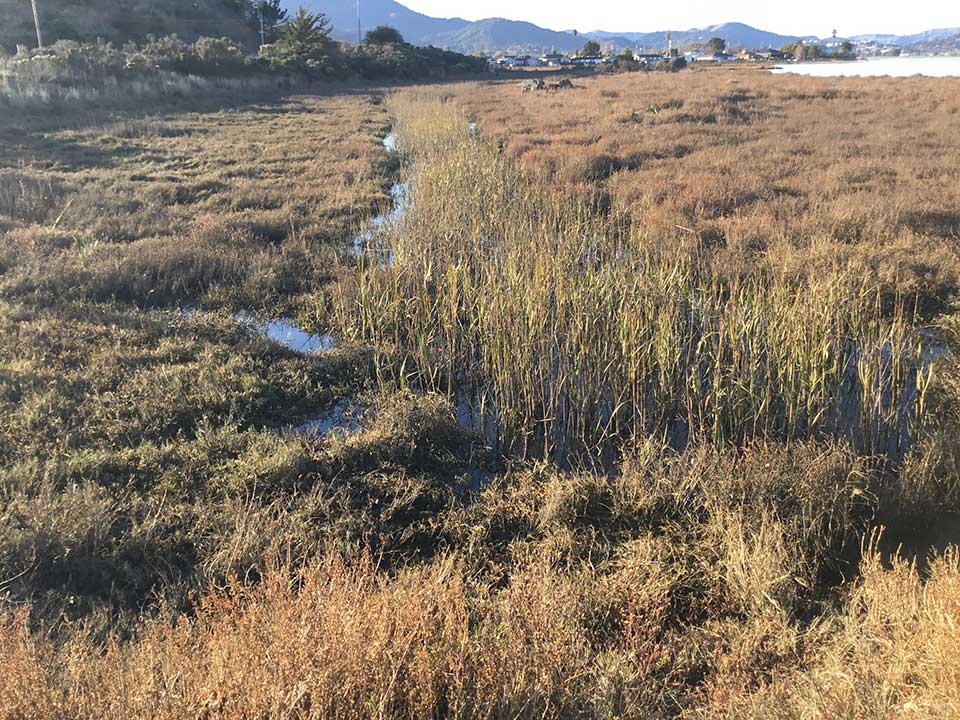
This tidal marsh and transition zone were first restored in 2003, and routinely receives habitat enhancements. The tidal marsh has revegetated naturally. Volunteers continue to work on the adjacent uplands, pulling weeds and planting native plants – some plants are planted each year during the winter rainy season which is the best time for planting in our Mediterranean climate.
For more information please see: Volunteer Workdays for Habitat Restoration
Stewardship Background
Marin Audubon (MAS) owns more than 500 acres of habitat, largely wetlands or associated uplands along San Francisco and San Pablo Bays. We’ve acquired and own these properties to provide habitat for wildlife. Property ownership brings enhancement and maintenance responsibilities. To fulfill these responsibilities and follow our mission, Marin Audubon plans and implements habitat restoration and enhancement projects, maintains habitats, and monitors activities on properties it owns. MAS’s Property Management Committee provides direct oversight of properties with approval of the Board of Directors.
Restorations focus on recreating tidal marshes and associated transition zone and upland habitats. Restorations usually involve moving dirt fill or levees to lower elevations or remove obstructions (levees) to tidal waters, and are usually undertaken with grants from federal, state or private foundations. These have included: Triangle Marsh in Corte Madera, Petaluma Marsh, Bahia in Novato, Corte Madera Ecological Reserve and Tiscornia Marsh in San Rafael (see below for more details).
Once elevations are suitable, tidal marshes restore themselves through deposition of seeds along with sediments. Uplands, however, require planting native species, followed by attention to ensure that they are not overtaken by invasive species, and that native plants thrive and provide habitat for native wildlife. Hence the need for most of our ongoing stewardship activities.
Habitat enhancement improves habitat. Enhancement usually takes place on diked historic marsh seasonal wetlands, and on transition zones/uplands adjacent to marshes. Adjacent uplands are a critical part of tidal marsh habitats. Enhancement usually involves planting native plants, removing invasive species and, for newly-planted plants, watering during summer for first several years.
Habitat enhancement has taken place on diked baylands at Bahia, Simmons Slough, and our properties at Black Point.
Enhancement activities are organized and undertaken by volunteers by working on properties or hiring contractors when we do not have enough volunteers or the expertise to do the work ourselves. We need and welcome volunteers.
Enhancement/Restoration Projects
Tiscornia – This 20-acre property was donated to MAS by Mary Tiscornia in 2008. The property consists of a segment of unimproved levee and approximately 20 acres of tidal marsh. MAS received a grant from the Marin Community Foundation in the amount of $115,000 to prepare a conceptual plan for a nature-based sea level rise adaptation project, and building on the MCF grant of $988,534, 534 Measure AA grant, administrated by the SF Bay Restoration Authority.
 Work on this grant is underway. Environmental Science Associates is undertaking engineering, biological and other technical studies after which CEQA will be initiated. Public outreach will be conducted by MCM. The grant funds will produce a design for a project that will restore tidal marsh, improve an inadequate levee, create transition zone habitat, and section of the bay trail on the levee.
Limonium Removal – Workdays to remove the non-native Limonium have taken place each spring over the last three years, coordinated by MAS Board Member Jude Stalker. These workdays take place on private properties not owned by MAS along the Bay edge from Sausalito north to Corte Madera. Limonium (sea lavender) was identified by the California Invasive Plant Council during their early detection program – program that aims to catch and remove invasive species when their populations are still manageable.
Bahia – MAS purchased the original 635-acre property and restored tidal marsh on 352 acres of tidal marsh in two phases in 2008 and 2013. Shortly after its purchase, the ownership of the blue-oak dominated upland hills was transferred to the Marin County Open Space District and the tidal marshes to the California Department of Fish and Wildlife. MAS retained ownership of 61 acres of seasonal wetlands and uplands and has been working on maintaining and enhancing these habitats ever since.
Bahia is the largest acquisition and largest restoration MAS has completed. Over four years after the acquisition, we hired consultants PWA and Peter Baye to prepare the marsh restoration plan, Point Blue to provide bird information, and consultants to prepare an Environmental Impact Report. We obtained permits from the Regional Water Quality Control Board, the Bay Conservation and Development Commission, the Army Corps of Engineers and the city of Novato. One hundred fifty-six acres of diked marsh was restored to tidal action.
The Phase 1 restoration project consisted of excavating channels within the marsh plain to create habitat and direct waters into the interior of the site, constructing ditch blocks to stabilize the channels, and breaching the levee in four locations to bring water into the site. The project also included restoring tidal action to a diked marsh, Mahoney Spur, owned by the California Department of Fish and Wildlife (then Fish and Game) as well as restoring approximately 15 acres of MAS property, including the former RV parking lot at the end of Bahia Drive, and on the East and West Peninsulas. Seasonal wetlands were enhanced on the Central Peninsula and lands south of the peninsulas.
The West Peninsula is adjacent to the Bahia Homeowners tidal channel and the East Peninsula is adjacent to tidal marshes along Black John Slough. These Peninsulas and the Central Peninsula had originally been constructed on tidal marsh as building pads for a housing development. We removed the fill placed for the houses from roughly half of the peninsulas adjacent to marsh and placed it on the other half of the peninsulas to restore the lowered areas to marsh. We planted native plants on the upland habitat. The Central Peninsula and areas south of the peninsulas were intended to be a mix of wet meadow, seasonal wetland and upland habitat.
In 2013, we finished the major restoration on the remainder of the former tidal marsh. The 216 acres of diked marsh referred to as West Bahia, was restored to tidal action by excavating three breaches in the levee. Restoration of this acreage had to wait until tidal action widened Black John Slough. If West Bahia had been opened to tidal action at the same time as Central Bahia, the project site would have diverted all of the water from Black John Slough, robbing Rush Creek and Cemetery marshes upstream of tidal exchange.
In 2011, MAS was awarded Supplemental Environmental Project (SEP) funds from the Novato Sanitary District, through a program of the State Water Resources Control Board. These funds enabled us to remove non-native plants from the banks of a tidal pond on another section of MAS’s property, south of the peninsulas and seasonal wetlands. This pond was not part of the major restoration project. It had large areas of invasive plants, particularly ice plant along its banks. The vegetation was maintained for five years after which the plants did not need maintenance. The plant survival rate was high.
We have planted native plants on a regular basis in the seasonal wetlands, throughout our property and followed up with weed removal and watering. Vegetation on the peninsulas has had limited survival. The poor quality soil and extreme compaction of the soil levee are suspected causes.
In 2019 we began to vegetate the Central Peninsula levees to improve habitat and outcompete the invasive radish that we had to remove every year. Donors to MAS as well as small grants from other sources including the Marin County Fish and Wildlife Commission and the Alpine Club Foundation have funded the planting and maintenance.
Our volunteers have done most of the work installing and maintaining native plants along the peninsulas, and seasonal wetlands and uplands on the rest of our Bahia property. We have hired contractors to remove large areas of non-native radish and other invasive and to plant large areas. Regular volunteer workdays were held for some years but are not currently occurring.
Our goal for Bahia is to create and maintain a complete tidal marsh habitat that necessarily includes seasonal wetland, transition zone and adjacent upland habitats to support species that depend on the tidal marsh habitat. Tidal marsh is restoring by natural processes.
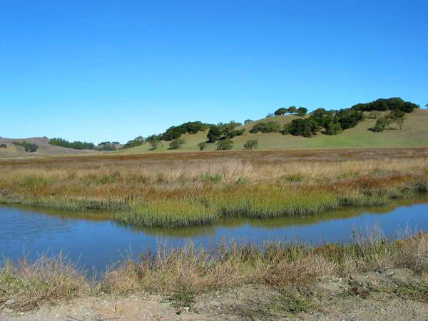
Triangle Marsh
Before our marsh restoration, the site consisted of approximately 5 acres of ancient marsh (i.e. marsh that has never been filed) plus filled land that stretched along Paradise Drive from the ancient marsh to the Marin Country Day School’s playing field. The restoration project involved removing the fill that had been placed when Paradise Drive was constructed. More fill was deposited later.
Fill was excavated along the length of the site from the playing field to the existing marsh to an elevation adequate to allow marsh to restore by natural processes. A channel was excavated through the lowered area to bring tidal waters back into the site. Tidal waters carry and deposit sediments and seeds of tidal marsh plants, thereby restoring the tidal marsh. A wide area along the bay edge that supported tidal marsh plants and an area along Paradise Drive were not excavated.
Approximately half of the fill removed was trucked to Redwood Landfill to be used as daily cover for the trash loads. The remainder was retained on-site, placed along Paradise Drive and formed into a berm to provide access and a high tide transition zone habitat.
We purchased plants from a local plant nursery, The Watershed Nursery, and hired them to help us plant the native species on the sides of the berm right after construction was completed. Special attention was given to the marsh side of the berm where the plants provide high tide refugia habitat for the endangered Ridgway Rails and other marsh wildlife. Plants were watered regularly during the first two summers by our volunteer, Lowell Sykes. The upland has been regularly maintained through the years.
Natural processes have restored the tidal marsh that is now fully vegetated. A small number of native plants have been planted annually to fill in where plants have not survived and/or to expand and enhance the habitat.
Bob Hinz has tended the plants, pulled weeds, and installed the plants every year with the help of other volunteers, including a local Boy Scout troop and students from Marin County Day School. Bob conducts volunteer workdays on the first Saturday of every month.
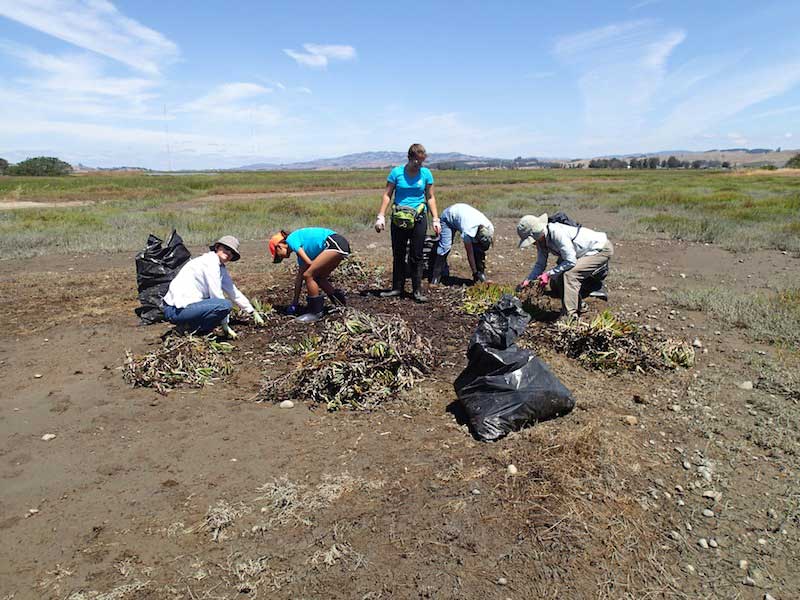
Corte Madera Ecological Reserve Tidal Marsh Restoration Project
The marsh restoration consisted of excavating fill from approximately one and a half acres on the Marin Audubon parcel and approximately one acre on California Department of Fish and Wildlife property. The land was lowered to an elevation suitable for marsh to restore on the eastern half of the sites. The excavated fill was placed on the western half of the sites to become a non-tidal upland. Three channels were also excavated in the lowered marsh plain to direct water into the site. The main channel connected to an existing channel in the existing marsh, a second channel to the north connected to the marsh plain PG&E restored several years before, and a third channel connected to the mitigation pond to the east. Small pockets of seasonal wetland that had developed around a drainage system, that had been installed years before in anticipation of developing the property, were consolidated into a seasonal wetland to the west.
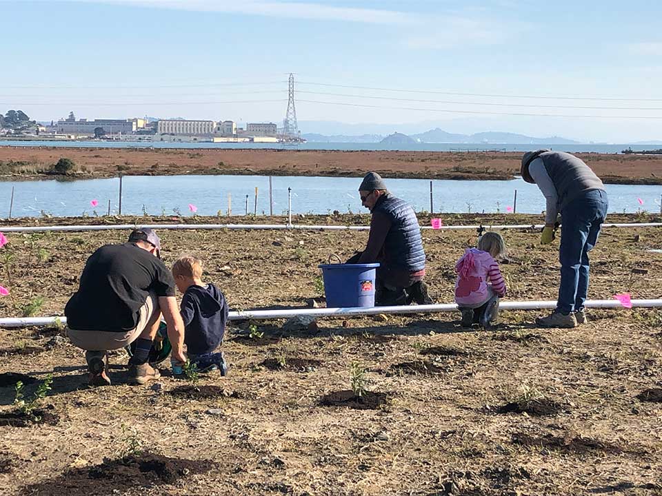
We planted 16,200 native plants to create high tide refuge habitat. Fencing also was installed to protect the marsh habitat. A path and marsh overlook and an interpretive sign were provided for the public.
Our effort now is to water, remove weeds, and mulch regularly to control invasive species, as well as maintain a string netting system to discourage Canada geese that feed on the newly planted natives. Volunteer workdays are conducted by Martha Jarocki & Meghan Kehoe on the second Saturday of every month.
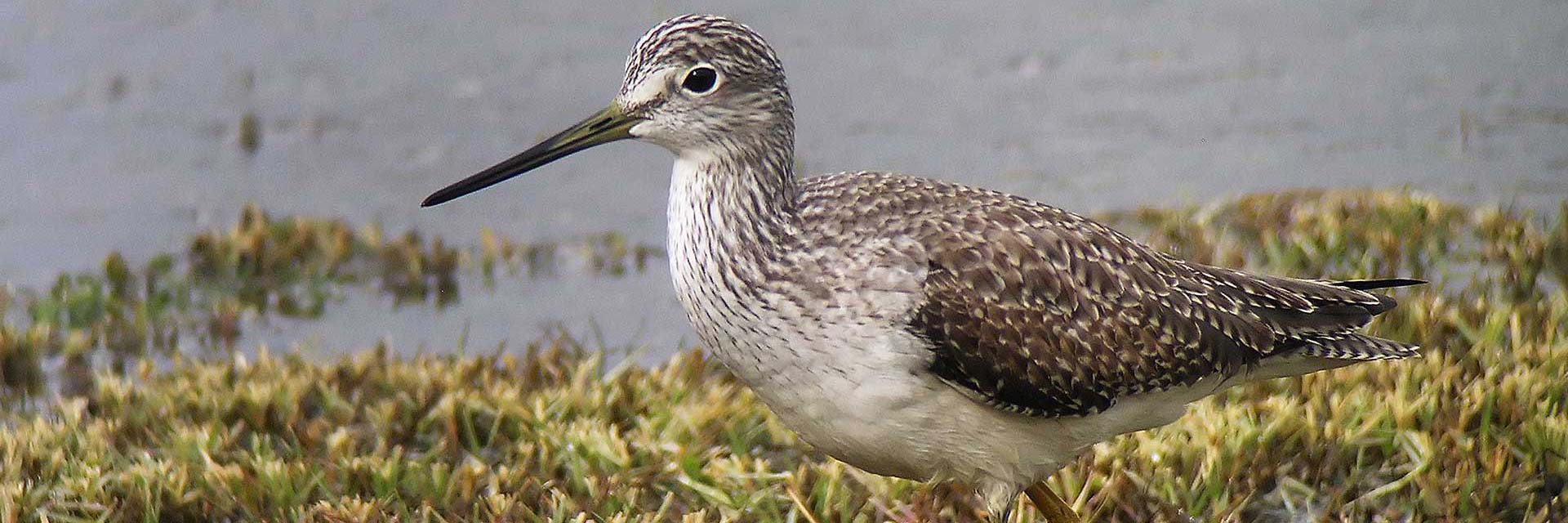
Our goal for the site is to create high tide refugia and adjacent upland habitat vegetated with native plants to support the endangered Ridgway Rails and other marsh dependent species. We anticipate the marsh will restore naturally.
Bahia Restoration Project
In 2009 MAS completed a project at Bahia to restore 317 acres owned by the California Department of Fish and Game and 61 acres owned by MAS. This project was designed by Philip Williams and Associates and had the objective of opening up much of the former baylands to tidal action. The construction contractor was Cooper Crane and Rigging. The main objective has been to increase the available habitat for the endangered Ridgway’s Rail, which already inhabits the existing marshes in the Bahia area. More on Bahia here.
Pickleweed (Salicornia pacifica.) is quickly establishing itself in the tidal zone. Growing beds have been constructed for raising Creeping Wild Rye (Elymus triticoides) and other native plant species for planting upland areas. Volunteers with the help of The Watershed Nursery of Point Richmond have been working to remove non-native vegetation which volunteers after a construction project.
An easement agreement with the Bahia Homeowners Association provides access across MAS property to their lagoon for recreational purposes. Signs have been installed to show the extent of the public access area and the areas being restored as wildlife habitat.
Extensive public access is available on approximately five miles of trails managed by the MCOSD on the Blue Oak wooded hills adjacent to the restored tidal area.
Simmons Slough Wildlife Corridor – MAS owns 145 acres consisting of two adjacent parcels, along Simmons Slough, a tributary of Novato Creek. NRCS holds a conservation easement on the property and provided funds for an enhancement project that was completed in 2009. The enhancement excavated four basins designed to hold water longer for habitat. Another enhancement project funded by the North Marin Sanitary District for past spills onto our property, removed non-natives and installed native plants.
Improving habitat on diked seasonal wetlands is difficult due to the unpredictable water regimes depending on the amount of rainfall and drainage. Dr. Peter Baye prepared an enhancement plan for this property that recommended planting patches of native species with the goal that the patches will eventually grow together. By planting more patches of native plants, including Creeping Wildrye (Elymus triticoides) and Alkalai Bulrush, we are seeing this happen at this property.
MAS has been awarded a grant from the county, part of a larger grant for the Deer Island Basin to enhance seasonal wetland habitat. Contractors will be hired with the grant funds to plant three-acres of native wetland species. This grant will also fund development of a water management plan that will better assure water remains on the site for habitat.
A few volunteer work days have been held on this site on an infrequent basis.
A demonstration Monarch Butterfly project is being accomplished with volunteers and hired workers.

Petaluma – Purchased from Waste Management Inc., 100 acres of this 182-acre property was restored to tidal marsh, with approximately one acre of adjacent levee-transition zone adjacent land and one acre of seasonal wetlands.
The restoration project design was prepared by PWA, consultants in hydrology and construction restoring 100-acres to tidal action, was completed in 2007 by Cooper Crane and Rigging. The vegetation management plans for the adjacent upland/transition zone was prepared by Plant Ecologist, Peter Baye Ph.D.

The project involved restoration of the 108 acres of formerly diked wetlands to tidal action. The levees had been erected in the 1950s. Major restoration actions included: breaching the levee in two locations; excavating interior starter channels to facilitate natural channel formation; constructing ditch blocks to encourage sedimentation of man-made channel ditches; lowering the perimeter levee to create high marsh habitat; constructing soil mounds to create high marsh and encourage vegetation to establish and provide wind-wave breaks in the site interior; blocking man-made drainage ditches to reestablish historic drainage patterns; constructing a new levee and low bench parallel to the railroad tracks to provide flood protection for the tracks; excavating borrow ditches to generate fill material for the levee, the bench, and internal marsh features; as well as creating three acres of seasonal wetland and planting the new levee, levee bench and seasonal wetlands.
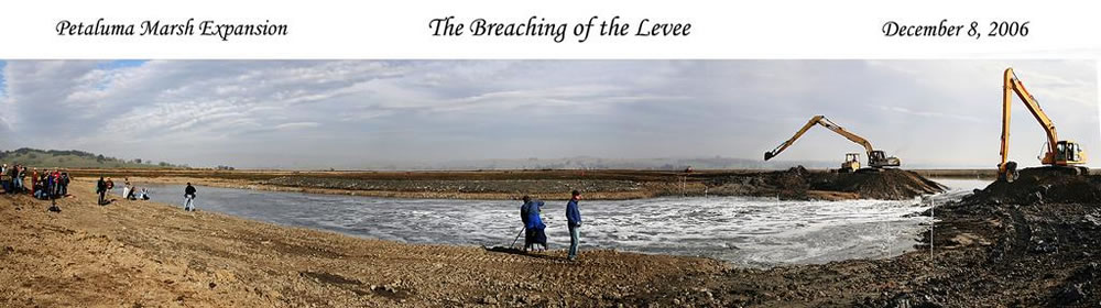
The first levee breach occurred in December of 2006 and the second in February 2007. In January of 2006, a significant storm event caused rainwater to pond on the neighboring ranch west of the railroad right-of-way. The flooding caused the breaching of the perimeter levee between our property and Mud Slough, resulting in multiple failures of the railroad embankment and flooding of our property. The railroad embankment was subsequently repaired by the rail authority.
Several attempts were made to vegetate the new levee and associated berm, with complete failure. Our concern led us to have the soil tested and the results revealed a high level of sulfides. The borrow ditch had been dug very deep to obtain soils to construct the levee and that brought up the salt-laden soils. We decided to allow rainfall to nature to leach out the salt. Native vegetation began to recolonize the levee side and bench after about ten years and has gradually expanded.
Due to the location of the site, landlocked north of the landfill, it is necessary to travel through the landfill and the Corda ranch, there have not been regular workdays on the property. MAS board members and friends work on the site on an as-needed basis to remove Dittrichia, broom and other invasives.
Our goal for this site is for the marsh to restore so that it is again an integral part of the Petaluma Marsh, which is the largest tidal marsh in the state that has never been diked. Monitoring reports indicate the marsh is progressing well toward full restoration.
Saving and Restoring the Petaluma Marsh Expansion
Our earliest association with Redwood Landfill was long before we even dreamed it was pos- sible to purchase any of its property. It was a privately owned landfill operated by Jordan Smith of the Smith family that once owned most of the area (Smith Ranch Road). Jordan would never invite or let us on the property, but in the ’90s several of us from MAS drove around the landfill a few times just to see what was going on. Then we were invited to meet by an employee of Cooper Crane and Rigging that had been hired as consultant to help with permitting for a project on the very property we now own. Needless to say, we objected to the project. They were not able to get a permit from the Corps of Engineers to fill wetlands. Not only did we later purchase the 182-acre site north of the landfill, but we later hired Cooper Crane and Rigging to construct many of our wetland restoration projects.

Located within the historic boundary of the 3,000-acre Petaluma Marsh, the largest natural (never been diked) tidal marsh remaining in the state, the property that we now own was diked off from the bay in the 1950s or early 1960s, possibly contemplated for future expansion of the landfill. It was leased to the neighboring Corda family for seasonal grazing pasture for their dairy cows.
When USA Waste took over the site, they brought in a new manager, Doug Sobey, who also joined Marin Audubon’s Conservation Committee. We had recently purchased Triangle Marsh in Corte Madera, there was new funding for the Bay (CALFED), the property was on our “Needing protection” list and this 182-acre property looked like a good possibility to purchase. At some point, I suggested that Doug help protect and restore the diked property by looking into the possibility of USA Waste selling it to MAS.
Doug worked some magic and persuaded the powers that be at USA Waste to sell the property, lo and behold, to us. The company hired a law firm to work with us on a purchase agreement. That led to a protracted negotiation on wording. Looking back, and even at the time, it seems like such a waste of time and money. We had agreed on a price of $250,000 based on an appraisal, which we had done. There was nothing controversial.
In the meantime, we embarked on the task of raising the necessary funds. We received a grant from a USFWS Small Grant program which we used to prepare a preliminary design, and we applied to CALFED for a larger grant. We were turned down because we mentioned the landfill in the title of the project, and the reviewers, who apparently didn’t read the proposal very closely, thought we were expanding the landfill. We reapplied, changed the name of the project to what it is today, and were awarded a grant of $352,000.
While negotiating the agreement, USA Waste sold the property to Waste Management Inc. We had some anxiety that they would not want to sell the property to us, but eventually the agreement was signed, and we completed the purchase a short time later in 2003. Waste Management still owns and manages the landfill.
In addition to the major grant from CALFED, we were connected up with Caltrans that needed mitigation for impacts to Sonoma Creek and wetlands for their Seismic Retrofit and Barrier Replacement of the bridge over Sonoma Creek. Ordinarily we do not accept mitigation funds, because it means wetlands are being destroyed elsewhere, unless the mitigation is for a public interest project, such as this, that would be permitted and constructed anyway. Caltrans also funded technical support from Coastal Conservancy. This combination of funding enabled us both to purchase and to restore the diked lands to tidal action.
With the Caltrans funding, MAS hired Philip Williams and Associates to develop a restoration plan. The plan involved breaching the levee in three places so that tidal waters would be introduced to the site from both San Antonio Creek and also from Mud Slough, a tributary of San Antonio Creek. Then we proceeded to get necessary permits—restoration projects are still subject to agency regulation as are all other projects.
One glitch in getting a grading permit from the county was public access because the property is landlocked, east of the Corda ranch, north of the landfill and west of the California Department of Fish and Wildlife’s Petaluma Marsh. We finally worked out access along the perimeter landfill road for views of the marsh.
Our project restored approximately 100 diked acres. The remaining approximately 82 acres are tidal marsh in two strips that look like mouse ears wrapping around Neil’s Island, a naturally occurring island along the Petaluma River.
Our original approach of reinforcing the existing railroad embankment was not acceptable to NWPRR, the owner of the railroad. They wanted us to reconstruct the levee. Liability concerns prevented us from agreeing to that. Instead we constructed a new levee on our property using both imported fill that we trucked in and fill borrowed from on-site. That was the most cost-effective approach, although it still raised the cost of the project, but it eventually worked out. The borrow ditch was a problem later. The on-site borrow ditch for the fill was very deep and, unknown to us, had very high levels of sulfide which prevented the growth of plants we planted along the levee sides and bench. They were the highest sulfide levels that had ever been seen by the lab where we took the samples for testing. Our attempts to re-vegetate failed for years, and finally we gave up. It is only in the last few years that native species have begun to recolonize naturally as rain has leached chemicals from the soil. On the other hand, native wetland plants, cordgrass and pickleweed, have restored the tidal area naturally as anticipated.
We were also able to remove the old hunting shacks that were on our property along Mud Slough. The property boundary runs along the middle of the slough. Those that remain are along the north side of the slough. One was allowed to remain at the request of the person who was using it. Most were collapsing. It was more efficient and cost effective to remove them before the restoration while the original levee was still in place.
The first breach took place in December 2006. The other two breaches followed with the restoration completed in February 2007. Today the site is a thriving wetland, once again functioning as part of the Petaluma Marsh. As anticipated, a channel network has formed. Higher areas within the marsh, created to guide channel formation, and much of the marsh plain has vegetated with marsh species. It provides habitat for the endangered Ridgway’s Rails, for other special status species, for large flocks of diving birds at high tides and for shore- birds at low tide.
The best place to view the marsh is from the SMART train. Look toward the east between the landfill and San Antonio Creek.
Arroyo San Jose – MAS acquired this property on a tax default sale . We have done some weeding, and are also working on partnering to remove the highly invasive English Ivy from any mature valley oaks and other native trees on this remnant riparian habitat
Arroyo Corte Madera – The segment we own is extends to the Bay from Camino Alto Avenue and was purchased on tax default sale. Enhancement activities have included removing highly invasive non-native acacia trees, removing other non-native plants and planting some native species. No regular volunteer days are held.
Black Point – Marin Audubon owns approximately 20 parcels in the Black Point area of unincorporated Novato. While a few of the parcels are on the wooded slopes of the Black Point hills, most of the parcels are seasonal wetlands, diked historic baylands that were diked off from the Bay probably 100 years ago. The lowlands flood seasonally with winter rains. Stewardship work has included removing invasive broom plants and debris from several of the parcels by volunteers and the Center for Social and Environmental Sustainability. MAS owns most of Norton Pond. We are interested in holding volunteer work days from time to time for needed maintenance.
MAS Stewardship on Properties Owned by Others
 Prior to purchasing properties, MAS undertook tidal marsh restoration projects on properties owned by others: government agencies, public agencies etc.
The Marin Audubon Society (MAS) began to implement wetland habitat restoration and enhancement projects in the early 1980s. Our restoration activities began with MAS’s removal of water hyacinth from Smith Ranch Road Pond, San Rafael, in the early 1980s. Subsequently MAS assisted the City of Larkspur with enhancement of the Remillard Pond, and the Richardson Bay Sanitary District with the enhancement of a pond along the Tiburon bike path. Since that time we have successfully completed projects on properties owned by the City of San Rafael, County of Marin, the California Department of Fish and Game, and the Marin County Open Space District (MCOSD) as well as properties owned by MAS. The map below shows locations of restoration projects we have been involved in.
1. SMITH RANCH ROAD POND ENHANCEMENT – MAS removed water hyacinth, a highly invasive exotic plant, which was invading this fresh water pond along Marsh Preserve. The pond is owned by the City of San Rafael. After about nine months pulling plants out by hand, funded from the City of San Rafael, Marin Audubon and the Marin County Wildlife and Fisheries Advisory Committee enabled MAS to hire a harvester and operator to remove the invasive plants. All of the plants were successfully removed in the spring of 1987, after MAS volunteers labored for about nine months pulling plants out by hand.
2. REDWOOD HIGH SCHOOL MARSH ENHANCEMENT PROJECT – In 1986, MAS received grants from the Coastal Conservancy and the Marin Community Foundation that enabled us to develop and implement a plan to enhance this 11-acre diked salt marsh. The wetland is owned by the Tamalpias Unified School District and is adjacent to Redwood High School. The enhancement involved deepening and widening channels in the marsh to improve circulation and fish habitat, installing a tide gate and a culvert to improve water circulation, removing invasive non-native plants, planting native plants on the adjacent upland, and installing fencing around the site to discourage people and dogs from entering the habitat. The project construction was followed by five years of monitoring.
3. CORTE MADERA ECOLOGICAL RESERVE RESTORATION PROJECT – One acre of filled land was restored to tidal action and a refuge island for endangered Ridgway’s Rail and Black Rail, a candidate species for listing, was created at the Ecological Reserve in 1990. The Reserve is owned by the California Department of Fish and Wildlife. Funds were provided by two dischargers who violated water quality criteria and the Regional Water Quality Control Board’s Administrative Civil Liability program. A five-year monitoring program followed construction. Some marsh plants colonized within six months, but the cordgrass took almost five years.
4. GALLINAS CREEK RESTORATION (Phase One) – This restoration was completed in three phases, each with different funding. Phase One was implemented in 1992 with Administrative Civil Liability funds for sewage spilled by nearby sanitary agencies, plus a grant from the Coastal Conservancy to develop the overall design plan. The site is owned by the State Lands Commission and was leased by the Department of Fish and Game to allow this project to be implemented. The project restored two and one-half acres of filled land to tidal marsh, and enhanced approximately one-third acre of seasonal wetlands and uplands. This first phase included removal of fill, excavation of channels, and breaching a levee to restore about one-half acre of filled land to tidal marsh. The Marin Community Foundation provided funding for development of the overall plan.
5. GALLINAS CREEK RESTORATION (Phase Two) – This phase was implemented in 1992 with Administrative Civil Liability funding from another sewage spill. Approximately 500 cubic yards of fill was excavated and about one-quarter acre restored to tidal action.
6. GALLINAS CREEK RESTORATION (Phase Three) – The third and final phase of this project was completed in January 1997 with funding from the Marin Community Foundation, the U.S. Fish and Wildlife Service, San Francisco Bay Program, and the Environmental Protection Agency.
7. MILL VALLEY RESTORATION PROJECT – Administrative Civil Liability funds for sewage spills in the Richardson Bay area funded this project that was implemented in 1993. Part of an old railroad levee and a collapsed culvert were removed to restore an area of tidal marsh, isolate a section of levee for a high tide refuge island for shorebirds, and improve circulation to the adjacent tidal marsh in Mill Valley marshes owned by the Marin County Open Space District.
8. DAVIDSON MIDDLE SCHOOL ENHANCEMENT – Administrative Civil Liability funds from a spill in San Rafael provided funding to (1) develop and distribute brochures to local businesses on proper handling of industrial toxic substances, and (2) implement an enhancement project for a creek that flows through the Davidson Middle School grounds. The enhancement involved purchasing and planting the native plants along the creek banks. The project was a joint effort with the Friends of Corte Madera Creek Watershed. Students from Davidson’s Environmental Club helped with the planting.
9. REDWOOD HIGH SCHOOL MARSH MOSQUITO ABATEMENT CHANNEL – This project took place at the same marsh as the Redwood High School Marsh (Project 2 above). It was implemented in response to vegetation damage caused by the Marin/Sonoma Mosquito Control District’s driving equipment through the marsh to spray Bacillus thuringiensis, which left track damage in the marsh. MAS widened and deepened several existing channels and the Mosquito Abatement District created small channels to drain several low areas that were ponding and producing mosquitoes. The project was implemented in 1995 and was followed by three years of monitoring.
10. BOTHIN MARSH FENCING – Using Administrative Civil Liability funds again, MAS hired a contractor to install fencing to prevent renters of an adjacent property from moving debris onto the wetlands and adjacent uplands of Bothin Marsh.